University Network of Atmospheric Observatories (RUOA-Sisal)
Sisal is now a node of the UNAM Network of Atmospheric Observatories (RUOA). ...
> More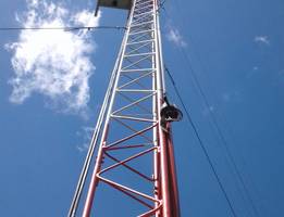
Meteorlogical-Fluxes Mast - Palmar
Experimental study of the Energy and gases (CO2, H2O) exchange between the At...
> More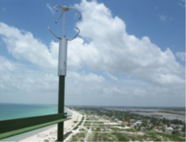
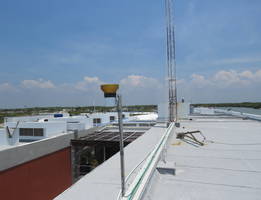
Meteorological Mast Sisal
A meteorological mast, instrumented with sonic anemometers was implemented du...
> More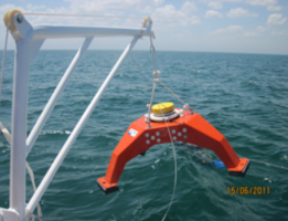
Wave and Currents in Shallow Waters
Since its creation (2010) the LIPC began to record data waves and currents in...
> More
Wave Bouys
> More
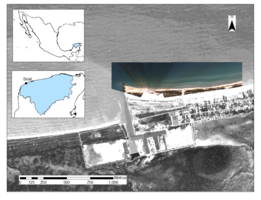
Videomonitoring Sisal
The image acquisition is carried out by the Remote Monitoring System for Beac...
> More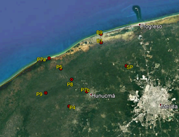
Monitoring network of the northwestern coastal aquifer of the State of Yucatan
The Laboratory of Engineering and Coastal Processes (LIPC) and the National L...
> More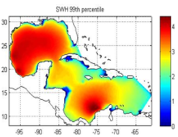
Gulf of Mexico and Caribbean Sea Wave Hindcast
The LIPC has generated a wave database for the Gulf of Mexico and Caribbean S...
> More
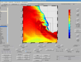
Regional Ocean Model System (ROMS)
The Sisal Academic Unit of the Engineering Institute of the UNAM was benefite...
> More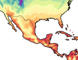
Análisis de Tendencias Climáticas y regionalización dinámica para México
According to the most recent report of the IPCC (2013), globally the surface ...
> More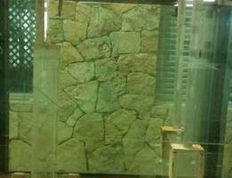
Efficiency analysis of a wave energy conversion device by water column oscillation. (OWC)
The results of the experiment are aimed at analyzing the performance of a wav...
> More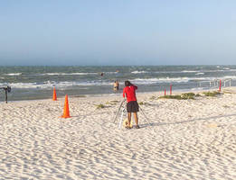
Coastal Dynamics on a Micro-tidal breeze dominated beach (NCSAL)
A comprehensive field effort devoted to the study of coastal dynamics in a mi...
> More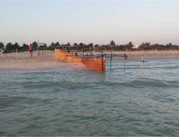
Resiliencia de playas a estructuras costeras (BRICS)
A series of field experiment have been conducted over the past two years to i...
> More
Beach Monitoring Program in Sisal, Yucatan (MORPHO-SISAL)
A high spatial and temporal resolution monitoring program has been conducted ...
> More
Study of flow reversal in the coastal lagoon La Carbonera
The Carbonera Lagoon inlet has experienced a very dynamic evolution since its...
> More
Video Monitoring Puerto Morelos
Pelagic Sargassum has been arriving in extraordinary large volumes at the Mex...
> More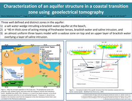
Electric Resistivity Images from the Yucatán Peninsula
Between 2015 and 2019 a data set of Electrical Resistivity Tomography was gen...
> More
Meteorlogical-Fluxes Mast - Bahía de Agiabampo
The coastal monitoring site “Bahia de Agiabampo” is located on the limits of ...
> More
Beach Morphology: El Palmar
A high spatial and temporal resolution monitoring program along the Palmar be...
> More
Characterization of the spatio-temporal variability of coastal currents adjacent to the Yucatan Peninsula
The characterization of the oceanic and coastal variability of the Yucatan Pe...
> More
Shallow water monitoring along the Yucatan coast
Off the coasts of Campeche and Yucatán lies an extensive marine region known ...
> More