Categories / Numerical Modeling / Ocean
Characterization of the spatio-temporal variability of coastal currents adjacent to the Yucatan Peninsula
Principal Investigator:
Dra. Ma. Eugenia Allende Arandía
Dra. Gemma Franklin
Dra. Gemma Franklin
Description
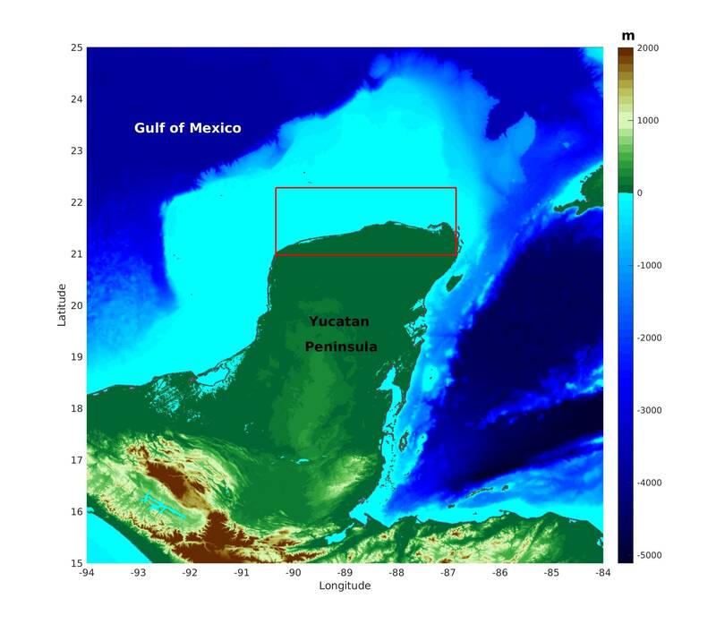
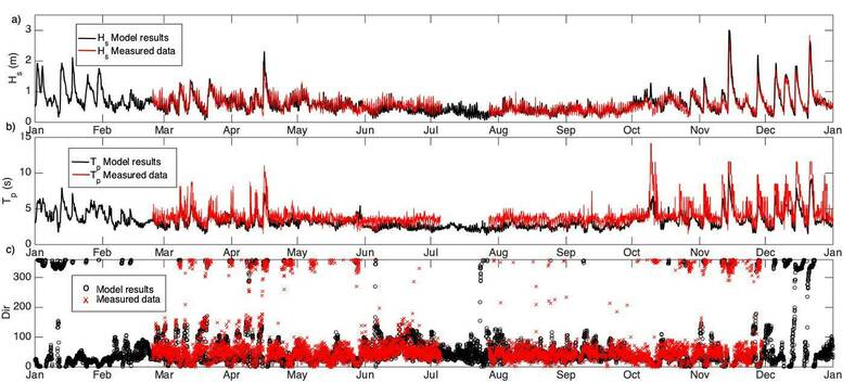
The characterization of the oceanic and coastal variability of the Yucatan Peninsula allows us to improve knowledge of the physical processes that have an environmental, social and economic impact at a local and regional scale. Specifically, understanding coastal dynamics will allow the conservation of ecosystem services, the identification and prevention of vulnerable situations, risk and management practices, as well as the evaluation of the effects of environmental and anthropogenic changes. On the other hand, it will contribute to the development of the country and increase the well-being and resilience of the populations, applying methodologies associated with the updating and improvement of research and education in the short, medium and long term. In the short term, with the training of human resources, in the medium term with the implementation of tools that help understand the ocean-atmosphere interaction processes that impact the country's coastlines and in the long term with the generation of databases and maps that allow the identification and design of adaptation measures for the planning of mitigation strategies and public policies appropriate for the region. To do this, meso-scale numerical models of the ocean and atmosphere will be implemented with high spatio-temporal resolution. These models will be validated with measured data and numerical simulations will be carried out from the continental shelf (regional) to the coastal zone (local). Subsequently, it will be possible to identify the contribution of atmospheric forcing that influences coastal dynamics on different time scales and in this way the areas most vulnerable to natural phenomena. At the end of the project, a publicly accessible database will be integrated.
The database will be available in the coming days.
Acknowledgments
The database will be available in the coming days.
Acknowledgments
This study was funded by UNAM-DGAPA PAPIIT Project IA101121 and Cátedras CONAHCyT Project 1146 (now Investigadoras e Investigadores por México) and the Laboratorio Nacional de Resiliencia Costera Project 299063. Technical support was provided by Ana Ramírez Manguilar, Gonzalo Uriel Martín Ruiz, José López González, and Juan A. Gómez Liera.
Gallery
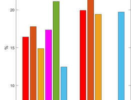
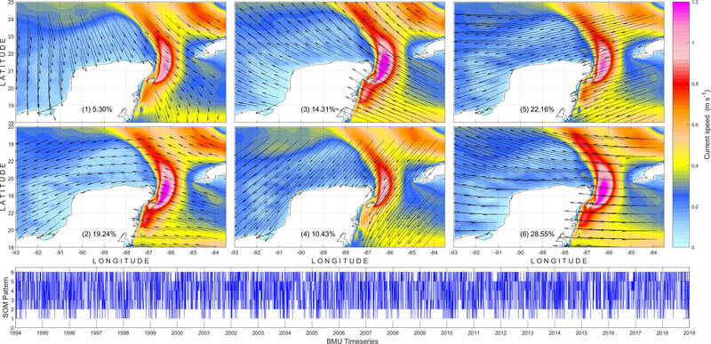
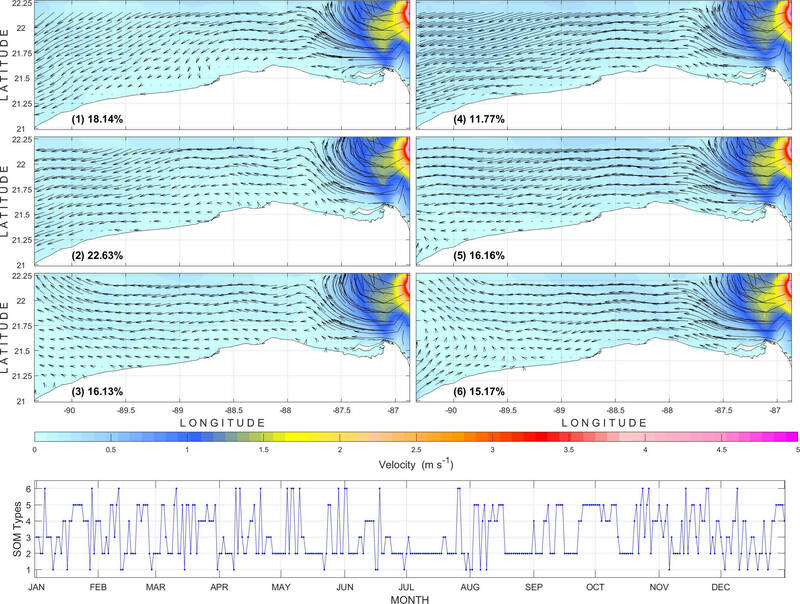
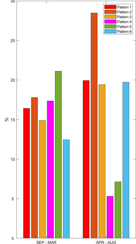
Percentage of occurrence according to atmospheric variability. September-March is the season of cold fronts or northerns in the region and April-August is the season of intense breezes.
