Categories / Experiments / Field
Electric Resistivity Images from the Yucatán Peninsula
Principal Investigator:
Mariana P. Gómez
Description
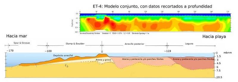
Between 2015 and 2019 a data set of Electrical Resistivity Tomography was generated. This data set provide geophysical information about the main geomorphologic zones of the Yucatan coast. The area covered on the transects extends along 9.5 km landwards and 6 km seaward. The dipole-dipole surveys were carried out in coastal dune, mangroves and deciduous forest (video 1 and Fig. 1); also, we have included a time lapse series during one whole tide cycle in the coastal lagoon La Carbonera (see La Carbonera section) (Fig. 1 and Fig 2.). The marine transects in drag mode show evidence of a resistive layer at 6 km from the coastline using a 10 meter separation between electrodes (Fig. 2), but it does not shows up when using a separation of 15 m (Fig. 3). A very complex work was the acquisition of ERT imagery at a Peten (in La Carbonera Lagoon).and a submarine spring (Xbuya-ha). In Quintana Roo, we had a collaboration with the Reef Geoscience Group from the Institute of Marine Sciences and Limnology at Puerto Morelos, to study the structure of the coastal reef Punta Maroma (Fig 6.). Currently we are working in a comprehensive analysis of our ERT imagery with the purpose of refining our conceptual model of the Yucatan coast aquifer. Moreover, this data is part of a PhD project to understand the role of the coastal aquitard in the geohydrology of the Yucatan Peninsula Coast (see the Monitoring network of the northwestern coastal aquifer of the State of Yucatan section).
Downloadable files:
Downloadable files:
- Map of ERT transects on the coast https://drive.google.com/file/d/0B-drnvOwRZ1qMkMtalh5QVdKbjQ/view?usp=sharing
- Technical report LANRESC (2017) (see PDF Files section) .
Publications and conference proceedings:
- Gómez-Nicolás, M., Ojeda, E., Salles, P., & Flores-Orozco, A. (2018). Structural characterization of a coastal aquifer using time-lapse electrical resistivity tomography. EGUGA, 11853. (Descarga aqui)
- Isalas, E.G. (2020). Espesor y geometría de los sedimentos de la zona del arrecife posterior en el arrecife de franja de Punta Maroma. B. Eng. Thesis. http://www.ptolomeo.unam.mx:8080/xmlui/handle/132.248.52.100/17233
Acknowledgements:
Catedras CONACYT, project 1146 Observatorio costero para estudios de resiliencia al cambio climático.
Gallery
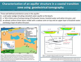
Fig. 1.
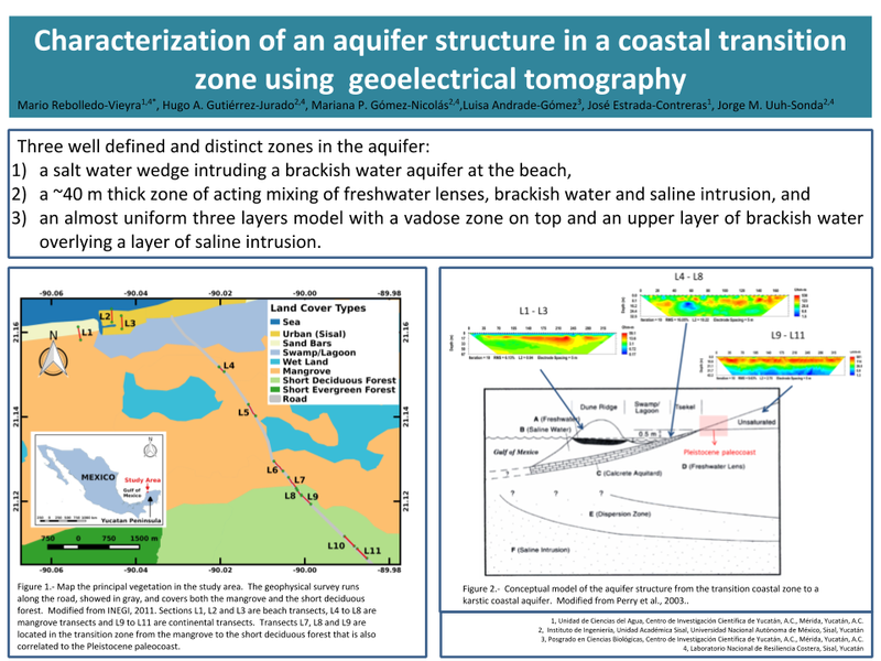
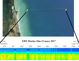
Fig. 2. Marine

Fig. 3. Marina 15
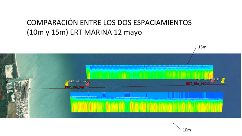

Fig. 4. Ojo de agua, La Carbonera

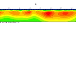
Fig. 5. Xbuya-Ha.
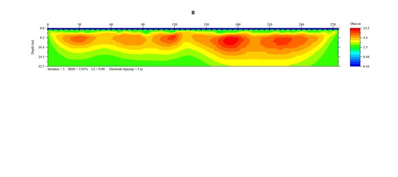
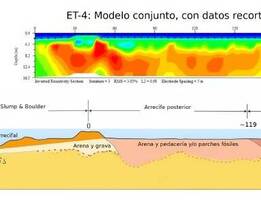
Fig. 6. Arrecife Eduardo.
PDF Files
Video gallery
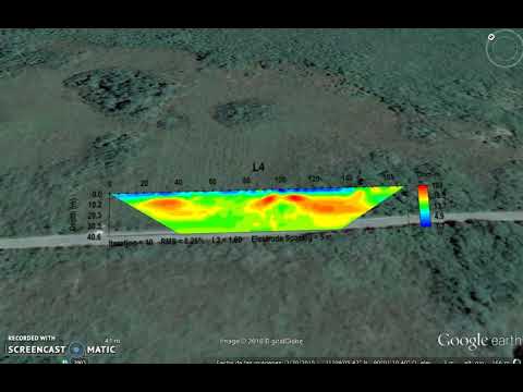 Video 1. Characterization of an aquifer structure in a coastal transition zone, using electrical resistivity
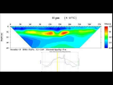 Video 2. Structural characterization of a coastal aquifer using time-lapse electrical tomography
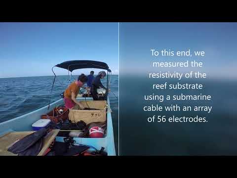 Video 3. Marine Electrical Resistivity Tomography at Punta Maroma, Quintana Roo, Mexico