Categories / Monitoring systems / Atmospheric
Meteorlogical-Fluxes Mast - Agiabampo - Back to Meteorlogical-Fluxes Mast - Bahía de Agiabampo
Result Graphs

Monthly evolution of turbulent fluxes (sensible and latent heat), evapotranspiration and carbon flux in semi-arid mangroves at Bahia de Agiabampo from November 2017 trough May 2019.

Daily evolution of meteorological conditions at the Navopatia EC tower location from November 2017 trough May 2019. Measured meteorological variables include: Relative humidity (RH), air temperature (Ta), incoming solar radiation (Rsolar) and daily precipitation (Pd).
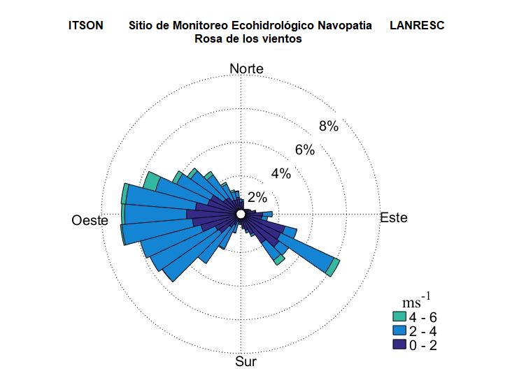
Wind rose chart showing the dominant wind direction and speed at the Navopatia EC site from November 2017 trough May 2019.
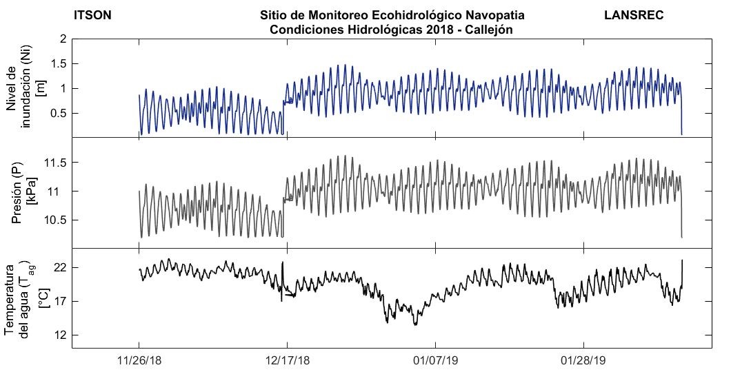
Tide level (meters), water column pressure (Kpa) and water temperature at the gauge station located to the west of Mazocarit Island, Bahia de Agiabampo, Sonora.
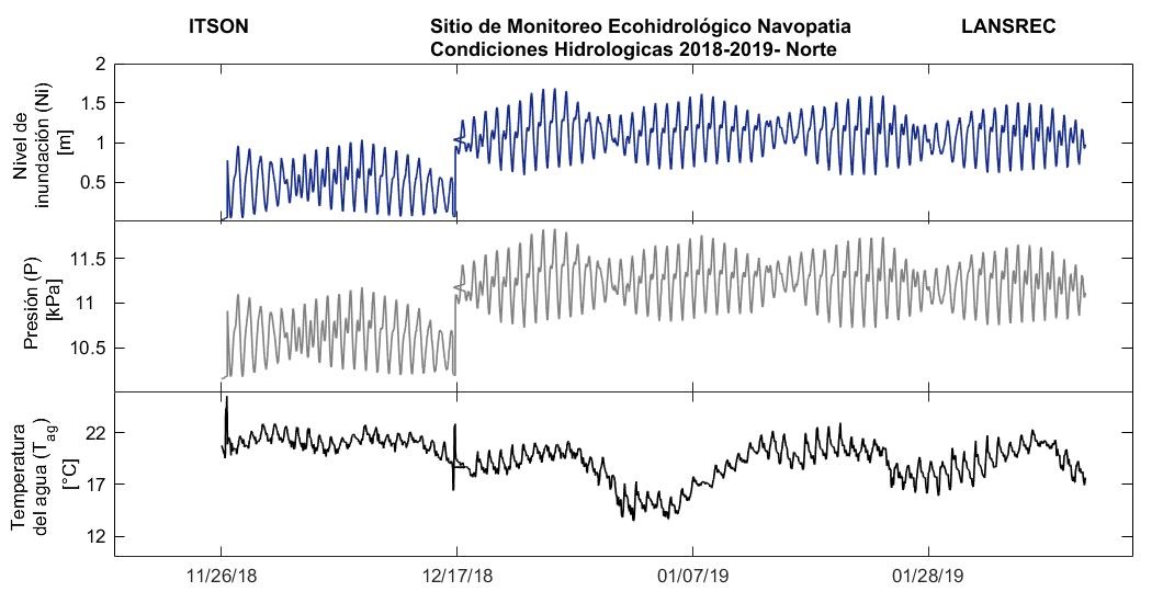
Tide level (meters), water column pressure (Kpa) and water temperature at the gauge station located to the North of Mazocarit Island, Bahia de Agiabampo, Sonora.