Categories / Experiments / Field
Area Location
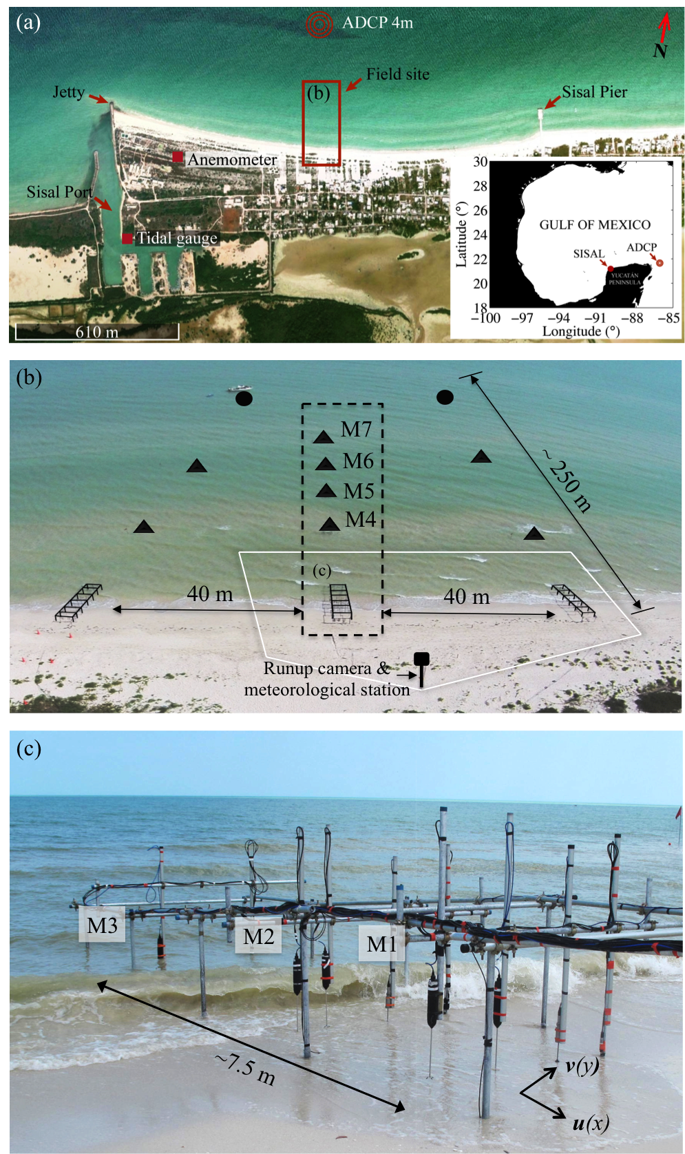
(a) Study area location (Mexico), (◉) wave sensor deployed offshore (ADCP), (■) tidal gauge, and (●) anemometer. The red rectangle shows the location of the experimental setup inside (b) the surf (Photo: Courtesy of AXIS Ingenieria) and (c) swash zones. The experimental setup in the (b) surf zone consisted of two (○) acoustic Doppler current profiler and () acoustic Doppler velocimeters deployed along three cross-shore transects. At each (c) swash-zone station an acoustic Doppler profiling velocimeter, electromagnetic current meter, and a pressure transducer (PT) were deployed. The enclosed area shows the field of view of the runup camera and the black dashed rectangle indicates the location relevant to this particular study. The field experiment conducted on the northern Yucatan coast from April 1 to April 12, 2014.
Forcing Mechanisms
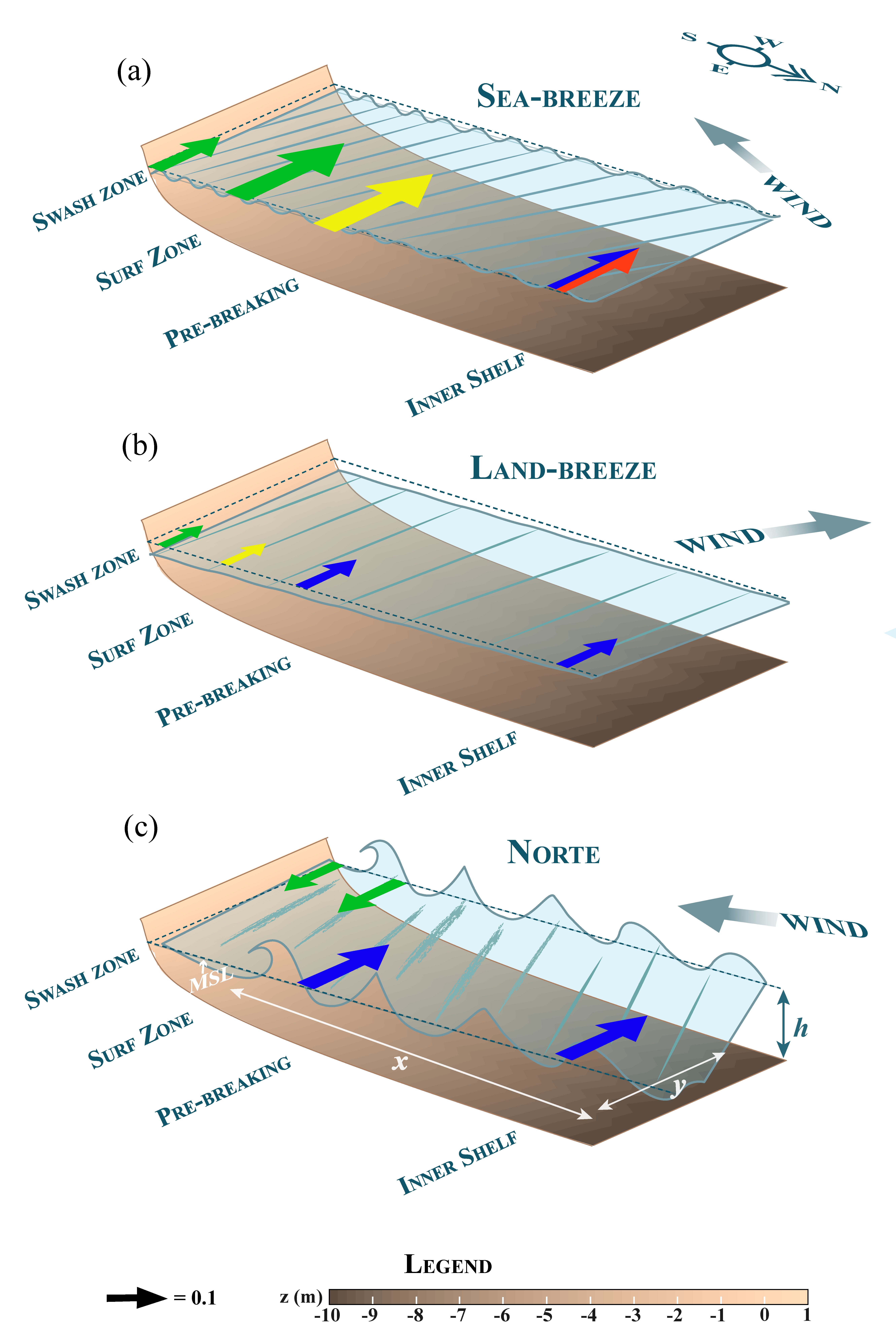
Conceptual diagram of the forcing mechanisms (wind: yellow; tides: red; YC: blue; waves: green) controlling along shore circulation during (a) strong sea-breezes, (b) intense land-breezes, and (c) Nortes based on the analysis of the NCSAL velocimeter data.